
Thursday 14th.
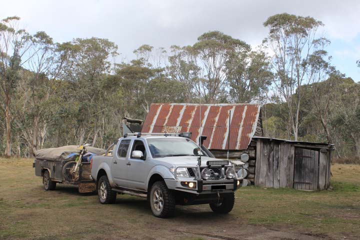
We were up and had the trailer hooked on, leaving Sydney by just after 6am, heading to the M2, then M7 for our trip to the Snowys. We drove straight through Canberra, making our way to Cooma where we arrived at 11.40am having done 411kms. Stopped for a coffee and lunch, from a local bakery, which was roughly a 30mins stop all up, we also re-filled the truck and reset the speedo, then headed back on the road for Jindabyne, arriving at 12.40pm, adding another 56kms on.
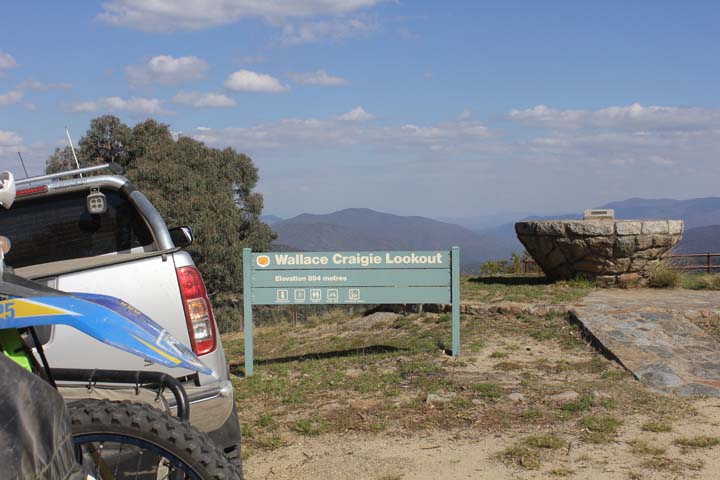
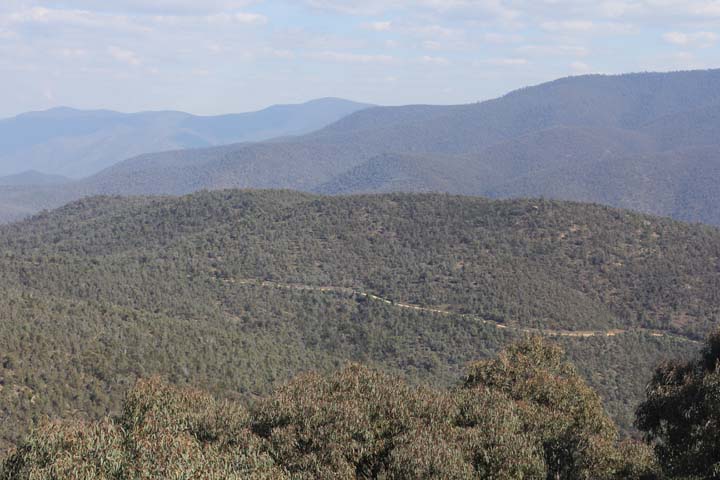
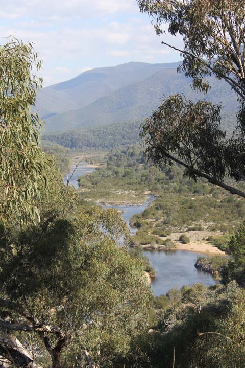
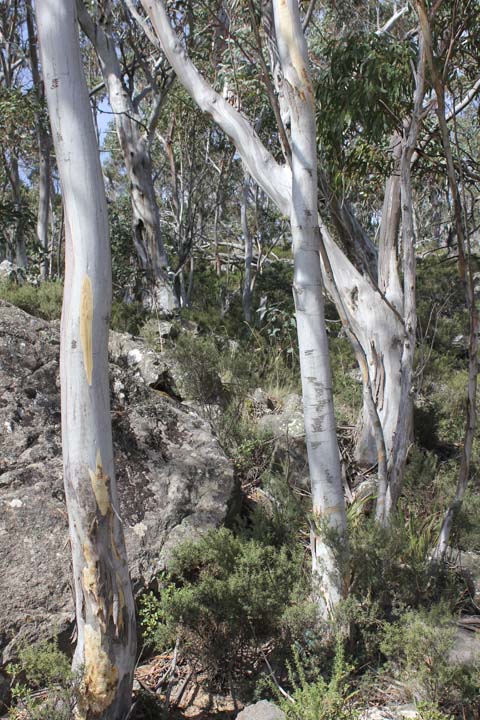
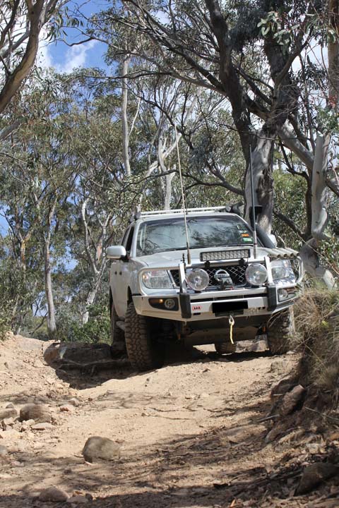
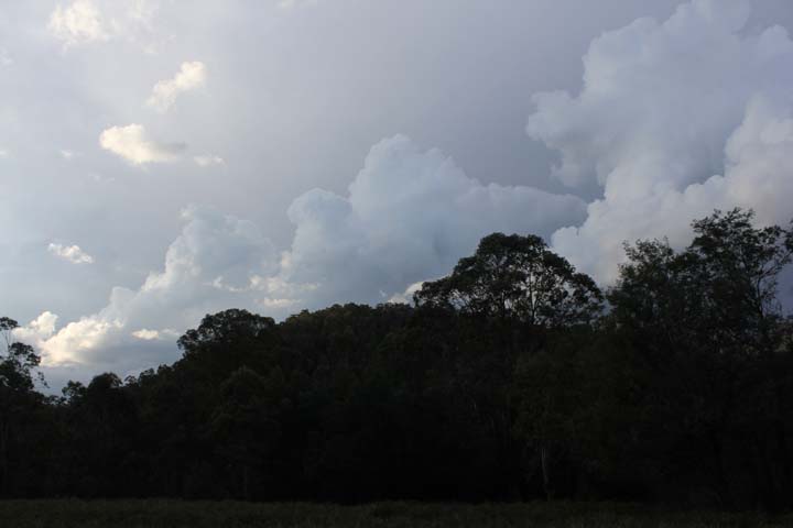
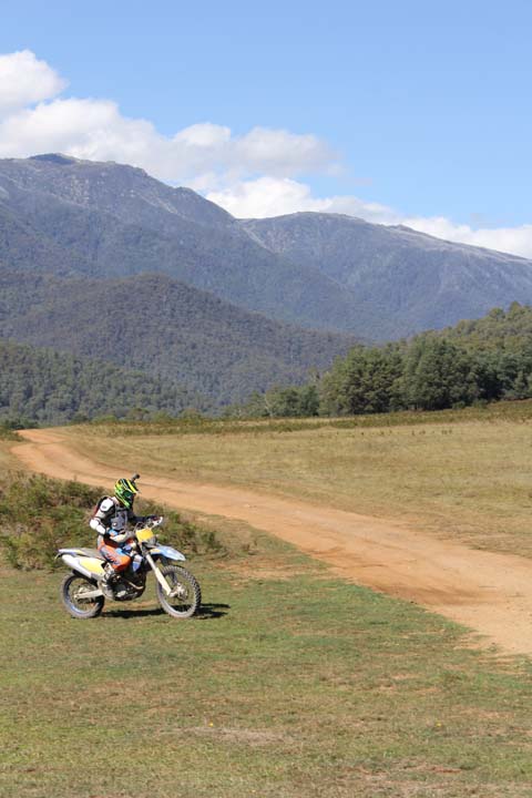
We took the left hand turn just through Jindabyne onto the Barry Way and hit dirt after about 15kms, it was fairly rough due to the amount of potholes, we stopped at Wallace Craigie lookout, which had an amazing view. We now felt that we were getting into the true wilderness of The Snowys, the road gradually descended to the Snowy River and followed it on a fairly decent dirt road all the way to Suggan Buggan. We had driven past quite a few camp sites beside the river, some of them small, but some of them large, Willis campground on the border of NSW and VIC looked the pick of the bunch.
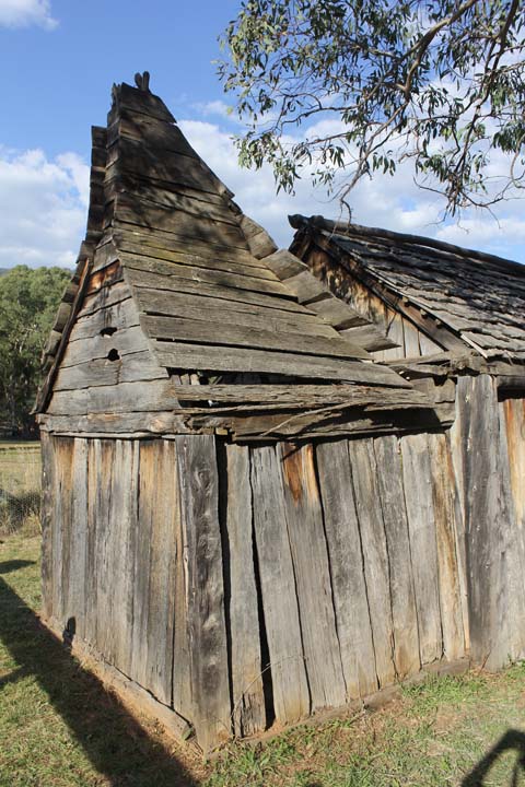
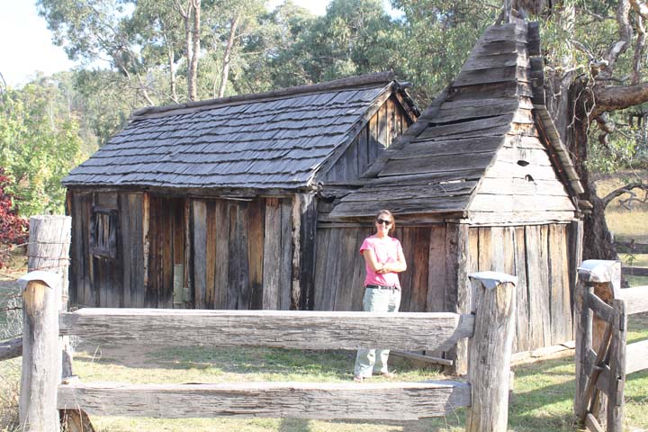
Driving through Suggan Buggan, we stopped and saw the historic School House of the area, then driving on, having a look at the campsite and deciding if we should push on to Native Dog Flat or stay at Suggan Buggan. After checking the maps and re-calculating the distance, we decided to push on to Native Dog Flat and glad we did, as it was a much nicer spot than Suggan Buggan. We arrived at 4.30pm, with the speedo reading 182kms.
The campground was fairly full, with a large group of campers and some single spots taken, with only a few spots left, finally, we decided on a spot near the entrance, which in the morning, would get full sun.
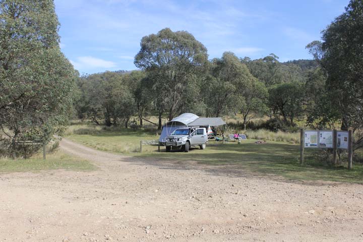
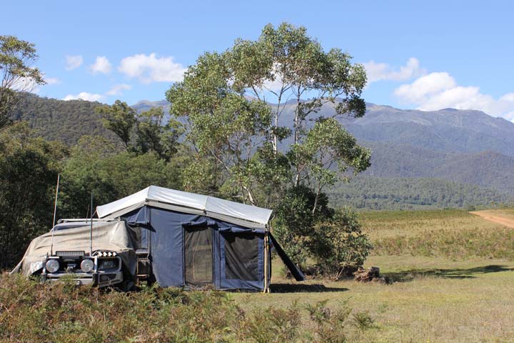
We set up the trailer and I somehow managed to get a weak fire going, which actually went out, before Jason had to ‘save’ it and because it was feeling cool already, a fire was well needed. We had left over chicken, corn and noodle soup, before watching the fire slowly burn, then heading to bed…was going to be a fresh night I think.
Friday 15th.
Slept fairly well, although a truck came into the campsite about 12.30am and set up for the night, which woke us both. I was cold during the night, so will pull out another sleeping bag for tonight. Slept in for a while, not rising until after 9.30am.
Had a slow breakfast, with that much needed coffee, which seem to be getting better each time I make them, they couldn’t get any worse! Packed lunch, then headed off for a sight seeing tour around the area, leaving at 11.30am.
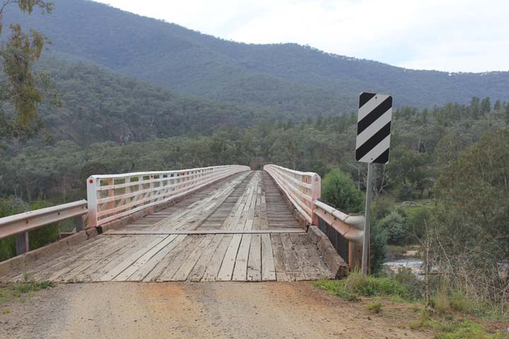
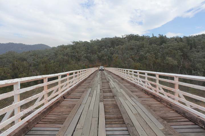
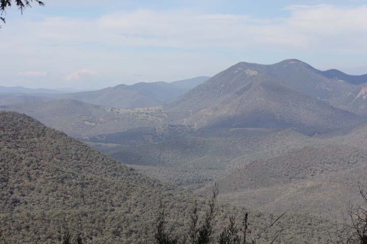
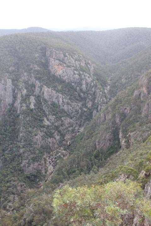
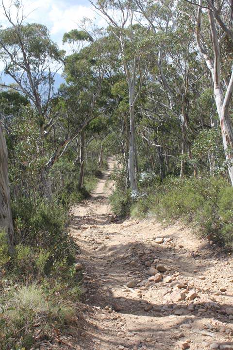
We headed back along Limestone Road, back to the junction of The Barry Way, continuing south, for about 11kms until we came to the left hand turn for McKillops Bridge. We drove along that road for a short period of time, before we started to head down a very steep, narrow, windy road, that literally hugged the side of the mountain, descending one in every eight meters. We have decided it is one of the most amazing roads we have seen, how it was just cut into the hillside, travelling a total of 27kms to reach the bottom.
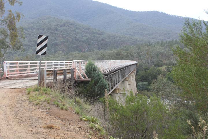
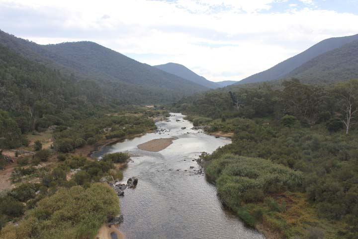
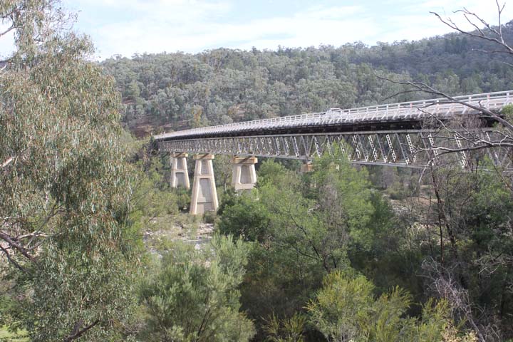
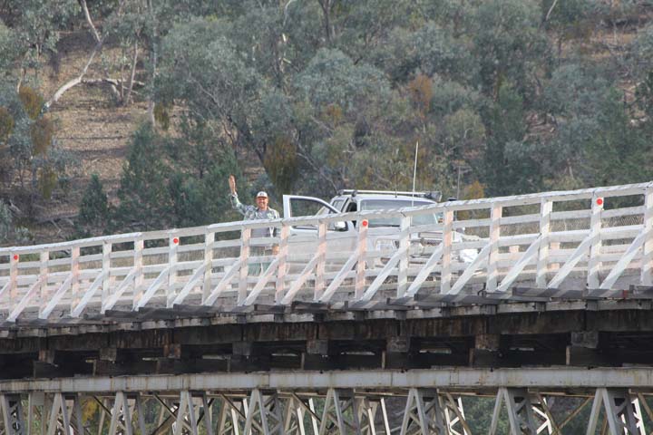
And WOW, what a sight McKillops Bridge was, there in the middle of no-where. It was built in 1935 and was unfortunately washed away by flood waters just before it’s official opening, hence they rebuilt it, making it 5m higher than the last, the second one opening in 1936, where it still stands today. It is 255 metres in length and well above the river below, an amazing feat back then to build such a structure, especially knowing how steep and windy the road is to get down there. We stayed there for a while, taking lots of photos, chatting to some travellers who were having lunch before heading off for more sight seeing, this time to Little River Gorge and Little River Falls. We stopped in at the McKillops Bridge Campground for our lunch, which was totally empty, bar some birds that were helping themselves to worms and spiders for lunch. It wasn’t much of a campsite, uneven, red dirt that was as hard as rock and dry. It wouldn’t be the first place we’d stay given a choice!
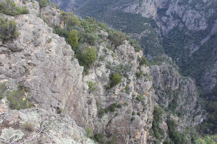
Headed back approx. 20kms to Little River Gorge, parked the car and took the 500m walk to the Gorge, which was mainly downhill. Yet again, we are amazed at how people find such places, as there in the middle of nowhere was an incredible sight. The Gorge was deep and a tiny river ran between it, which it had been doing for millions of years, thus creating the Gorge itself. Back up the hill we climbed, which wasn’t terribly steep, but making ex-ironman Jason rather puffed!!
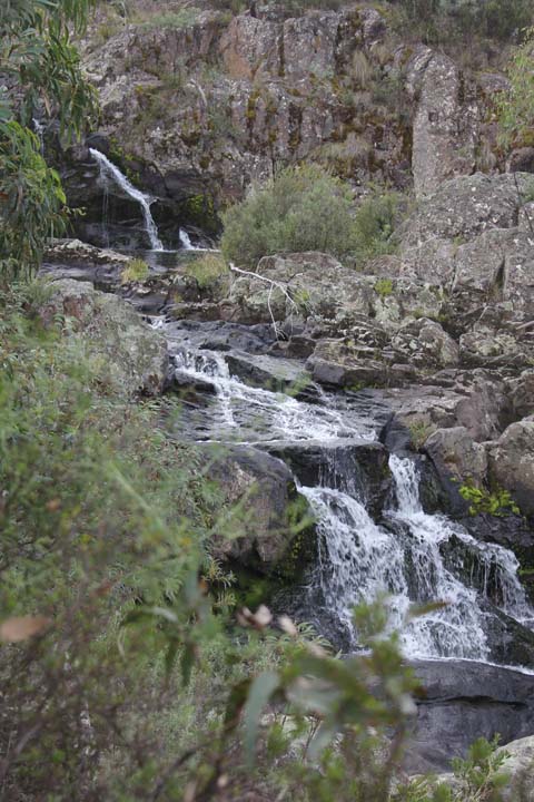
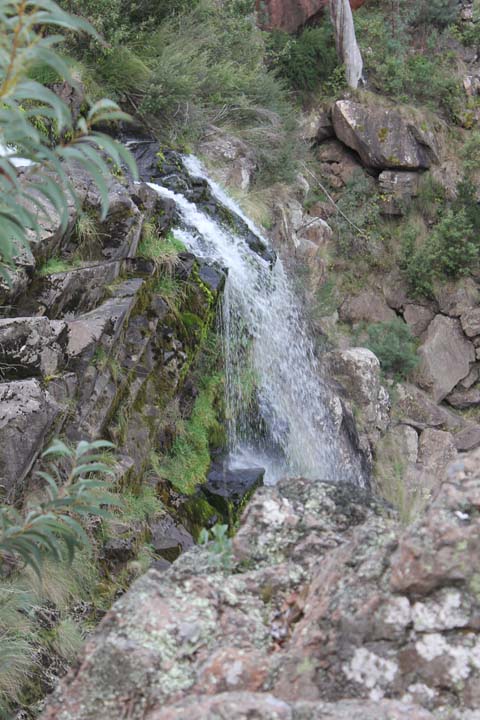
Travelled maybe 4kms down the road and stopped for the 400m walk to Little River Falls, which were a very pretty sight. Not terribly large, they cascaded down the rocky outcrop along the side of the hill, the last section of the falls, maybe a few meters in length, finishing in a sweet little pool, yet again, another amazing site in the middle of nowhere.
Back to the truck to visit the place Jason has been looking forward to…the town of Seldom Seen. Headed back along McKillops Bridge Road for about 10kms before turning left onto Barry Way, Snowy River Road to Seldom Seen, which was about 2kms down the road. Drove past a Telstra phone box, then past a house, then across Seldom Seen Creek, then nothing…that was it! On all of the maps we had been studying, there was a petrol logo (not that we needed any) and a phone logo and nothing else, well the the phone was still there, but there was no petrol anywhere to be seen and here we were thinking we might pick up a sticker for the fridge, or a beer cooler saying ‘I’ve been to Seldom Seen’, not to be a little disappointed to say the least.

We thought we may as well continue down this road, following it another 10kms to Gelantipy, which on the maps, had every logo, petrol, beds, toilets, camping, water, first aid, eating places and even an airport maybe…wrong again! We drove past a tiny wee school, maybe two or three houses, some cows, an SES outpost and that was that. Thinking we now can’t read maps or understand what the legends mean, we turned around and headed back to the campsite.
Drove back up Barry Way, Snowy River Road until the left turn onto Limestone Road then Black Mountain Road for the 30kms back to Native Dog. Arrived after 5pm, having done roughly 155kms all up to a now very empty campsite, everyone had left during the day and it was now just us.
Got the fire going and settled in for the evening, having sensational pre-marinade ribs for dinner cooked over the fire, with cobs of corn, delicious! Had cups of tea and hot chocolates, before heading into bed for a hopefully warmer sleep than the night before after a great day of touring and sight seeing.
Saturday 16th.
Oh the noises one hears in the bush. A wee bush mouse sniffing and having a lovely time exploring through our kitchen, shoes, tables and chairs and the brumbies, what a noise they make at times. Soft hooves treading here and there, soft neighs, probably to each other, then piercing neighs that make the hairs stand up on the back of your neck, does keep one awake at all hours of the night.
Had a very slow morning, deciding to have a go up the Cobberas Track, that we read had some good 4WDriving. Left about 10.30pm and made our way to Cobberas Track. It was fairly easy going to start, we passed a small campsite that two groups had occupied, before continuing on. Not long after seeing this group did the terrain start to change, it was quite heavy bush on either side of the track then the descents started with a some very steep ones we had to negotiate, with some tricky rock steps, ruts, narrow turns through trees, before some very steep ascents of much the same. We were planning on driving to the junction of McFarlane Flat Track which then joined Ingeegoodbee Track, but didn’t make it that far, as it was fairly tough going, there were no stunning views through the thickness of the trees and after 2 hours of driving we had only done 14.5kms. We stopped and had lunch in a spot that someone had camped at previously as there were remnants of a campfire before deciding to turn around and head back to Native Dog.
It was a tough track, which although is fun and which we did enjoy, we would much prefer to be going somewhere than just doing a loop of a track to say we have done it. Back at camp and early enough to get a great fire going to get some good coals for dinner we settled in for the afternoon. Had a roast lamb with vegetables for dinner, not taking long to cook at all with the coals we had managed to create. Was a coolish evening, so it wasn’t long after a cup of tea that we were in bed reading and again, listening to the noises of the bush come to life after we have gone to bed.
Sunday 17th.
We started the day a lot earlier than previous days as we had to pack up the trailer for a fairly long day on the road, heading to Geehi. We had breakfast and coffees, while going about our business of packing the trailer up, was a very foggy morning, with the finest of mist in the air. Everything was done and the trailer hitched up, ready for us to leave at 10.30am.
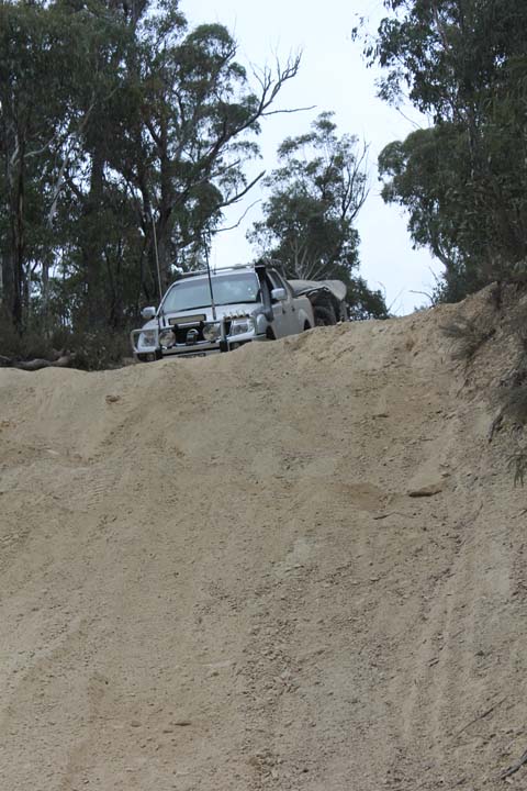
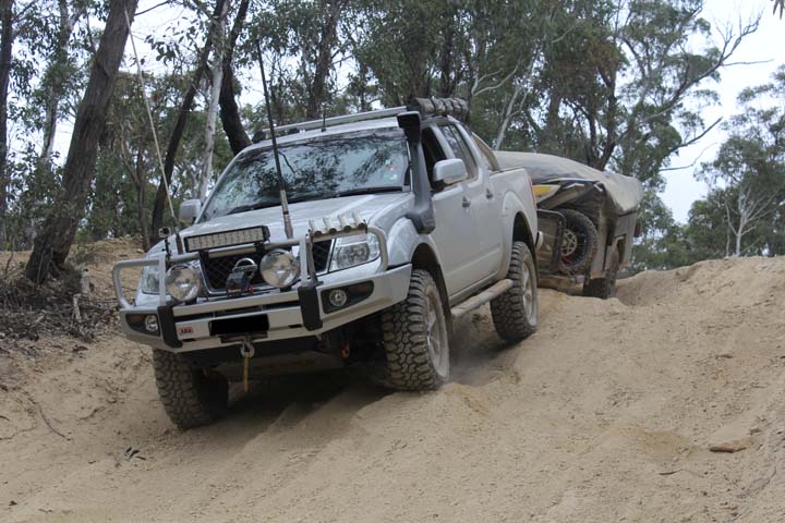
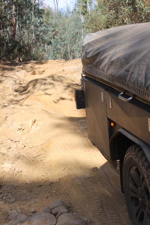
We travelled the 6kms to the right hand turnoff for Limestone Creek Track, reading the sign that said ‘this track is not recommended for trailers’, we were about to find out what they meant. We hit the track at 10.45am for the unknown venture ahead of us. We came to a large group of campers in one of the campsites and Jason hopped out to have a chat to see if the trail was suitable for us, they said it was fine, as we were heading in the right direction as there was one very steep descent that, the previous day 4WD’s, coming in the other direction had to be winched up, due to the steepness and softness. The track had various long descents and ascents, some very rough, where I actually got out to direct Jason down, with a few steep rock steps to manage, the difflockers were used on more than one occasion on this track. It was tough going with the trailer, nothing that we hadn’t really done before in our previous trip to the Victorian High Country though, finally coming to the end of the track at 12.13pm, having travelled just 13.8kms and ready to start McCarthy’s Track.
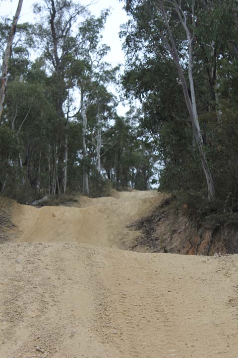
McCarthy’s Track wasn’t as bad as Limestone Creek Track, with only one really tricky section, that was also slightly slippery, that we had to negotiate, stopping just before the junction of Davis Plain Track to have a chat to some trail bike riders that had done a large loop, which we discovered had left from the campsite where Jason had discussed the condition of Limestone Creek Track, he was mildly jealous of this group of eight riders and longed to join them. McCarthy’s track only took us 45mins and totalled only 8.3kms before we headed onto Davies Plain Track which was going to take us all the way down into Tom Groggin.
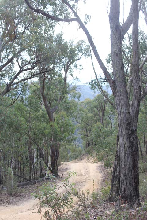
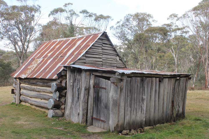
Started Davies Plain Track at 12.50pm and travelled along fairly flat ground, obviously following the ridge of the mountain range. We came to Charlies Creek campground not too far along, and it was a lovely campground situated on the creek, we have earmarked this one for a stopover when we come back through this way in the future. Another few kms saw us reach the Kings Plain Track junction, which was a no through road. Still travelling along the ridge, we started a very mild descent at about 9kms with the trees also changing, going from gums at the top of the ridge, all white and weathered, to a different variety all together. We stopped in at Davis Plain Hut for a look, then as we continued we saw some great camping sites past the hut that would be well worth a visit in the future. The terrain changed again at about 14kms along the track and it felt like we were driving through rainforest.
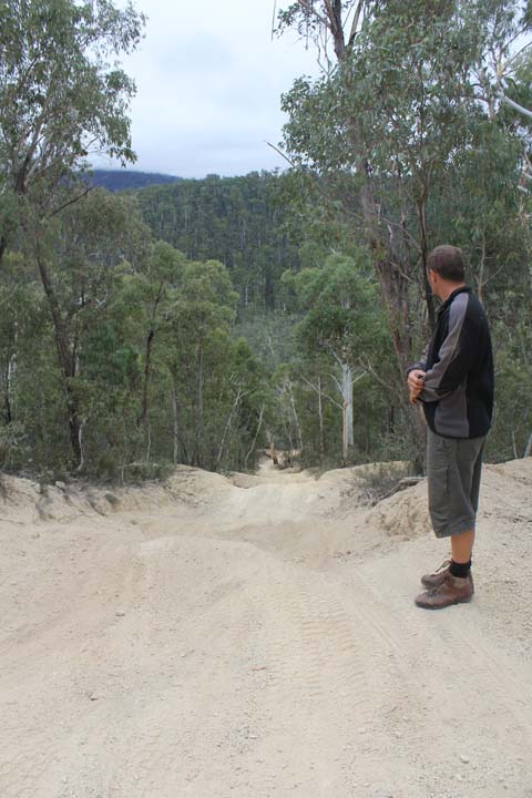
We then started the steep descent making our way off the ridge of the mountain, 15kms in the track became extremely rutted, so with the descent and the ruts it was making for some very slow and careful driving, the truck doing all the work in 4WD low. This descent lasted for a few kms, at times going over erosion mounds and seeing just sky above, to then be facing down hill and only seeing track. We finally descended to the bottom, making our way across the Murray River and into Tom Groggin, having travelled 23.4kms and arriving at 3pm. It had been a long, tough drive along the Davies Plain Track, but well worth it, we think, making it one of the best 4WD experiences we have had thus far on our travels, definitely adding this to the top of our resume portfolio!
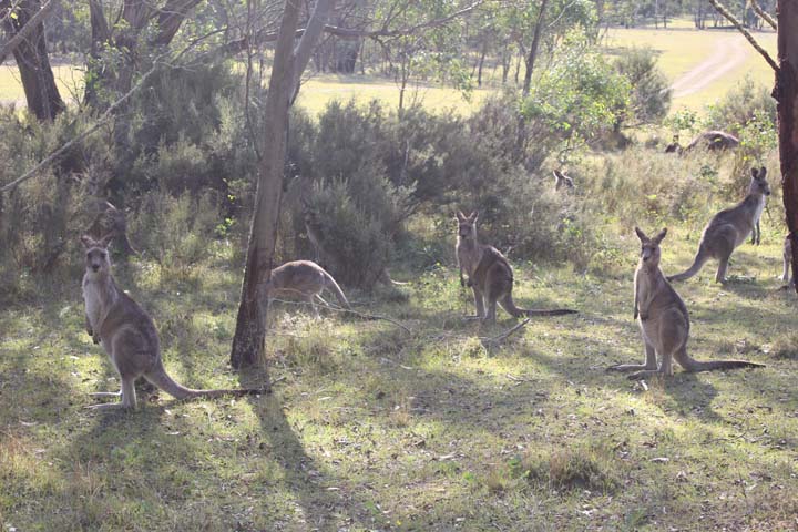
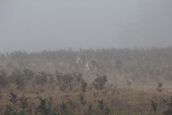
Travelling through Tom Groggin, the kangaroos appeared from every which way, making us still think that kangaroos just don’t cross the border into Victoria, as we hardly saw any there at all, just hearing brumbies make there way through the campsite at night. We made our way up the Alpine Way, only 21kms, to Geehi the next stop on this adventure.
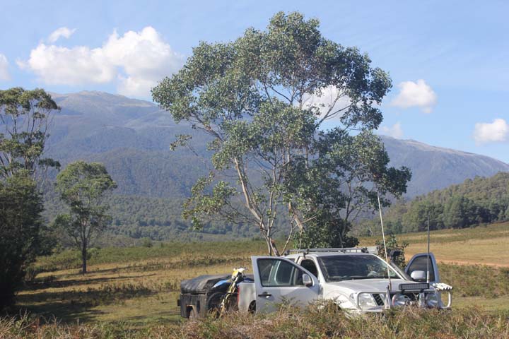
Had a bit of trouble finding Geehi camping area, as we drove into a rest area first, then drove out, drove along the Alpine Way a bit more, then turning around and driving down a dirt road that lead to Geehi, only to read that trailers were prohibited, so driving back along the Alpine Way again, we went into the Geehi rest area again. We finally found it though. Drive through the rest area, where there are some camping sites and where Geehi Hut is on the right, to the left is a river crossing. Over this crossing there is a large expanse of area and a track that leads you to Kebbles Hut, where there is more camping. We followed the track up and over a slight incline, where there is yet more open area, with the track leading to Old Geehi Hut. We decided for the view of the Western Fall of the main range and the sun, so turned back and camped in the large open area on the top of the first incline and what a stunning place to camp.
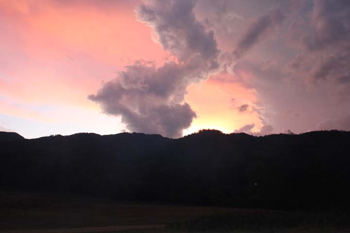
Set the trailer up and got a fire going, although we both noted that it wasn’t nearly as cold as Native Dog Campground had been, so been that few hundred meters lower than we were, played a large part in the temperature difference. There were dark clouds to the east of us while we were setting up all making very deep grumbling noises, making us worry a small bit, but which actually amounted to nothing. We had jacket potatoes, garlic butter, cheese and mince for dinner, celebrating a great day of one our best 4WD adventures with that all important bottle of champagne! Went to bed after a very satisfying and exciting day.
Monday 18th.
Woke up to a very heady fog that had descended over the valley during the night. We both had had good sleeps, Jason saying that he got up at about 12am and the sky was clear, full of stars and a very bright moon. Had a lazy morning of breakfast and coffees, before Jason went off on an adventure on his bike, coming back a short while later, a lot earlier than he had planned. He came back to let me know that at Old Geehi Hut someone was packing up his campsite…it was Pat Callinan! I told Jason to go back and say we were huge fans and to get a picture…I watched Pat drive past with a drone following him, filming, then the film crew came past 10mins later.
Jason came back from his ride and said that Pat was now jut down the slight incline, setting up camp, so we would walk down there later in the day. We had lunch and Jason went for another quick ride, but when he came back, he said that Pat had left again, must be filming his TV show. Bummer not getting a selfie with him then!
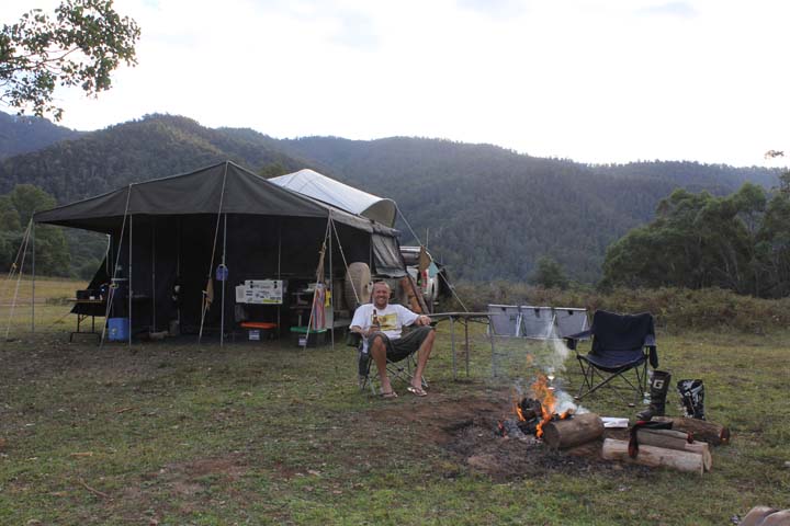
We got the fire going early as we were cooking lamb shanks for dinner and they had to be done slowly…good luck with that one! It was very pleasant sitting by the fire watching the mountains getting pinker as the sun set behind us, listening to our shanks bubble away in the camp oven.
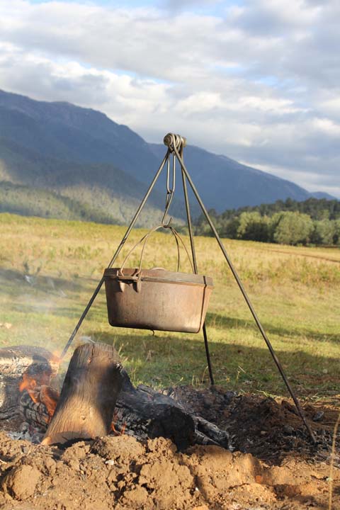
Our dinner was finally ready by just after 6.30pm and they were delicious, well worth the wait. We stayed up a little while, discussing the route we were going to take home tomorrow, back to reality. It turned out to be one of the latest nights we had had, in bed by just before 9pm!
Tuesday 19th.
Jason was up at 7.30am starting the pack down of the trailer, which was rather wet from the heavy dew we had had the night before, hoping the sun will dry most of it. I was up a bit before 8am, glad Jas had lit a small fire as it was rather fresh, only 5.5deg. We had breakfast, while packing the trailer away, the sun drying the canvas of the trailer, but only the sides facing it. Everything was away and we wiped the canvas so it wasn’t as wet, then finally got the trailer down before heading on our way home, via Tumut and Gundagai.
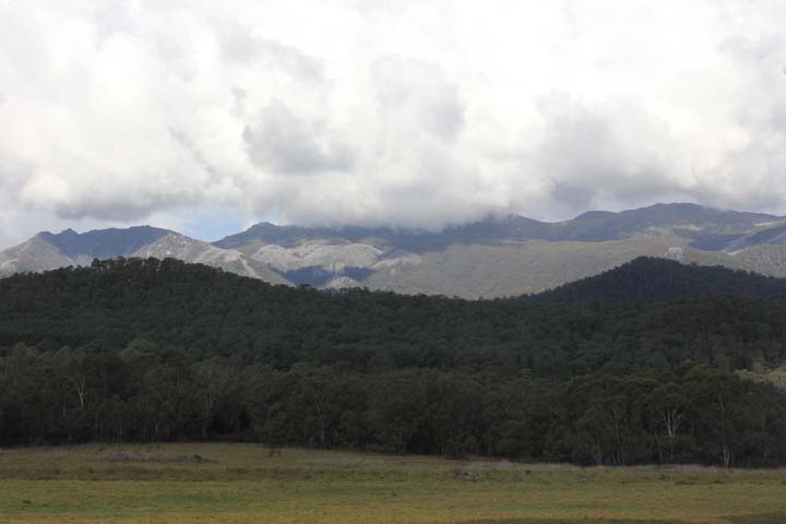
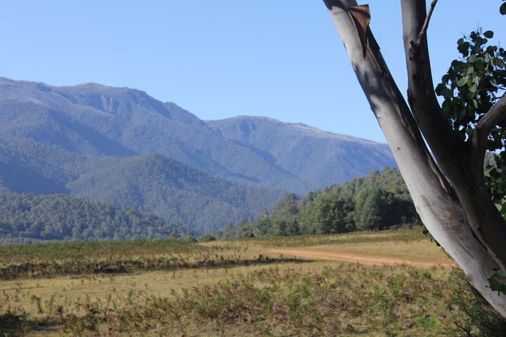
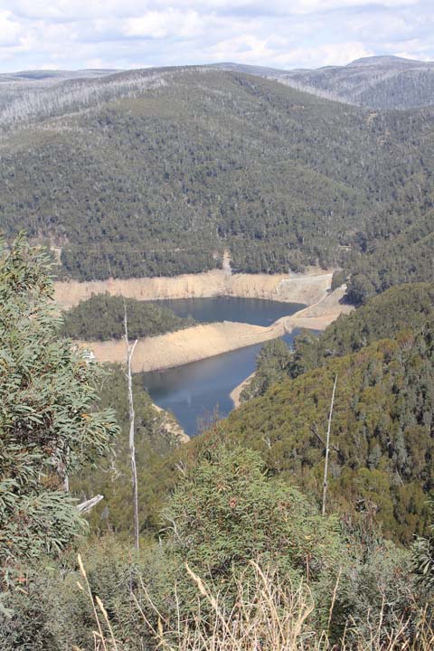
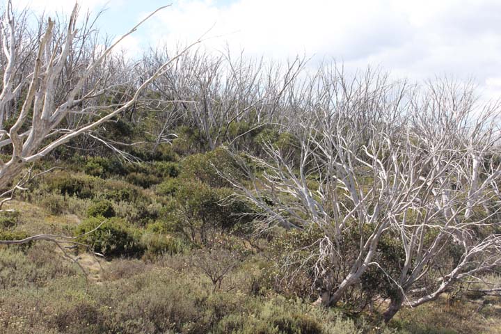
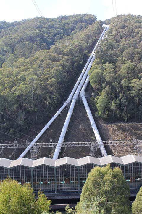
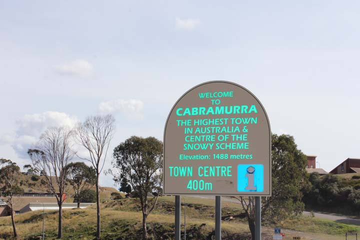
We left at 10.30am, heading for Tumut, via Khancoban, while travelling along this road, we stopped at the Murray 1 Hydro Electric Power Station which was an impressive sight. We decided to follow the Tooma Road to Cabramurra, which is Australia’s highest town. It was an amazing drive, bitumen, two lanes, extremely windy, with some very long, slow descents and ascents, snaking it’s way through some strange trees, not sure whether alive or dead. We were lucky enough to escape a two hour road closure delay on Tooma Road, arriving 10mins before it re-opened again for one way traffic, following an escort vehicle from A to B! We stopped for a look at Selwyn Snowfields which were totally empty, of both people and snow, coming back out onto the Snowy Highway, heading towards Tumut.
We arrived in Tumut at 2.10pm having done 195kms, so a long slow drive. Got coffees from a local bakery and had lunch of wraps that Jason had made. I took over the driving from here and off we went to Gundagai, arriving just before 3pm, where we filled up the tank and aired up the tyres for our journey home.
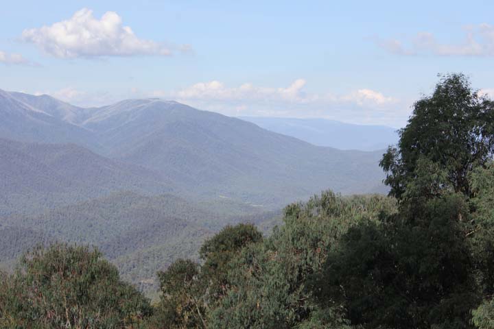
Arrived home just after 7.30pm having done a total of 615km, taking a total of 9 hours, with a few short stops and the long, windy road travelled from Geehi to Tumut. This trip was a great short break, with amazing sights, stunning views from above and below the great Snowy Mountains and some of the most fantastic 4WD tracks we have done thus far.